
Cuale River Island Video Tour
Features & Amenities
Restaurants
Bars
Museums
Shopping
Arts & Culture
Performances
Photo Spot
Downtown
Summary
Right in the heart of Puerto Vallarta, la Isla del Río Cuale (the Cuale River Island) is not just a cute little green, park area—it’s a vibrant cultural sanctuary embedded in the city’s history and part of its natural beauty. Even though in 1926 it was just a temporary sand bank formed by a forking Cuale River, it has now become a beloved public area and a bustling part of downtown PV. The island is now a peaceful, shaded urban oasis amidst the active Vallarta “centro”, offering both locals and tourists a chance to enjoy scenic views, interesting bridges like La Iguana, and a number of local stands, store and cultural attractions. Whether you’re out looking for a souvenir or just find a peaceful place to relax, Cuale River Island has a unique blend of serenity and cultural richness right in the middle of downtown Puerto Vallarta.
Read more about it all and more (f. ex. how is the island related to the Hollywood elite?) find out how you can get there easily and more, just keep on reading this article.
Cuale River Island
- Cuale River Island was formed in 1926 and has evolved from a temporary island to a permanent cultural and recreational space in downtown Puerto Vallarta.
- Originally used as a public park in the 1970s, the island now also hosts a museum and the Cuale Cultural Center.
- A shade-rich oasis, it provides a peaceful escape in the middle of the bustling city, featuring lush vegetation and relaxing park areas.
More…
- Various access points and bridges, La Iguana from the north, hanging bridges connect the island to the Downtown area and the Romantic Zone.
- Home to markets, restaurants, and artisan stands, offering goods ranging from silver and ceramics to souvenirs and traditional foods.
- The island is centrally located, dividing downtown Puerto Vallarta from the Romantic Zone, with multiple access points via pedestrian and vehicle bridges.


Introduction

Souvenir and market stands on the Cuale Island
What today is the Cuale River Island exists since 1926 (originally known as Isla de Santa Clara & Isla de Los Niños – The Island of the Children), when the river grew and forked into two separate arms leaving a temporary island in between them. In the 1970s, it was used as a public park and recreation area.
The “Isla del Río Cuale”, the Cuale River Island, currently is a peaceful and relaxed shade-rich oasis in the middle of downtown Puerto Vallarta.
Where is the Cuale River Island?

The name of the island derives from the river that starts off some 30 miles away up in the mountains. Cuale was a mining town, where different pre-Hispanic objects have been found, which are exhibited in the Cuale Museum.
The Cuale River is one of the seven rivers that start off in the Sierra Madre Mountains and end up in the Banderas Bay, it divides the town into the downtown area north of the river and the Romantic Zone (Old Vallarta) to the south.
There are two main bridges for vehicles and pedestrians, one on Insurgentes St. (northbound) and another on Ignacio Vallarta St. (southbound), they are connected to the Island with stairs that descend from the street. There are also a few hanging bridges that allow pedestrians to get to the island.

River Café, Isla del Río Cuale / Cuale River Island Puerto Vallarta
Gringo Gulch – Cuale River Island Pedestrian Bridges
Iguana Bridge
La Iguana Bridge was built as part of Puerto Vallarta’s downtown revitalization project, it brought two important parts of the town together and injected a bit more life into the cultural end of the Isla Rio Cuale.
Since 2012 this very nice pedestrian bridge has connected Cuauhtemoc Street in the Gringo Gulch (north of the island) to the Island right by the Cultural Center on the East end of the island. In the past there was no easy access between these two colorful parts of town, this bridge has changed that.
It offers some very nice views of the Island and Old Vallarta to the south, the river is also in full display as well as the houses that line the edges of the Cuale River, many of them the original homes that established themselves in the Gringo Gulch.
You can see on photos from The Night Of The Iguana documentary that John Huston was there overlooking the river and a much less developed south side.

La Iguana Bridge (Puente de la Iguana) Cuale River Island to Gringo Gulch
This bridge, known as La Iguana Bridge, is a large white structure, using the same handrails found on the pedestrian bridge that goes over the Cuale river between the Malecon II and the romantic zone (Old Vallarta) so I will guess they were both built by the same company.
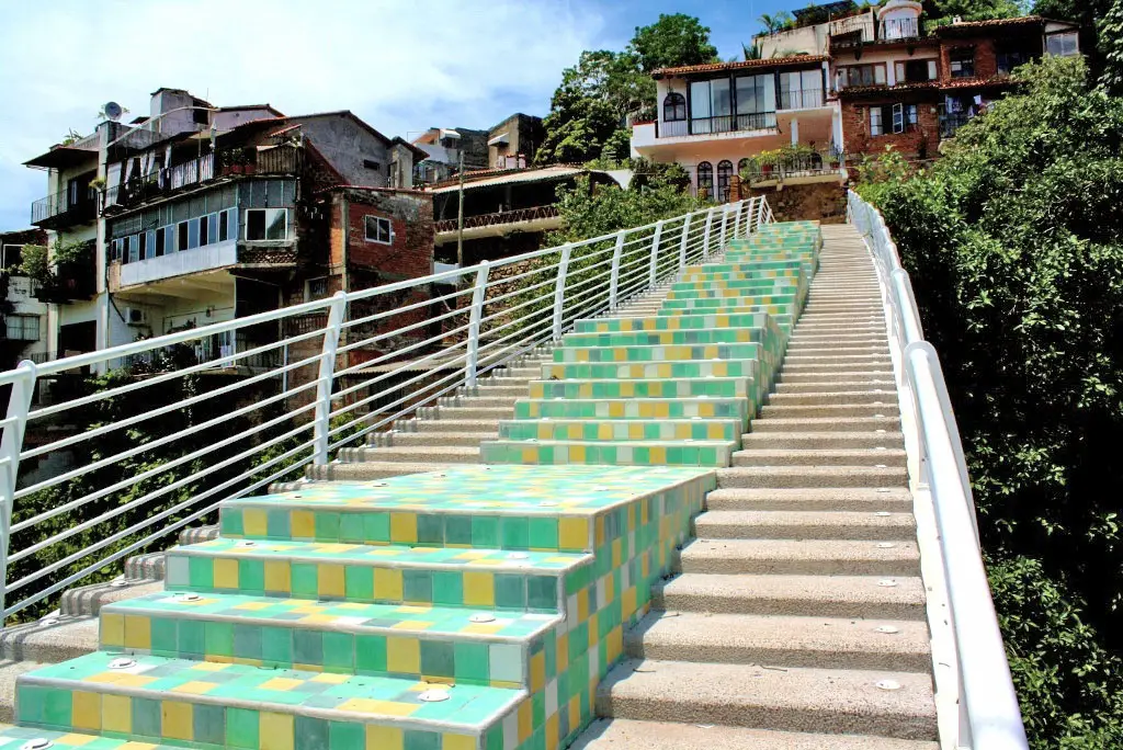
La Iguana Bridge from Cuale Island to Gringo Gulch
What makes this bridge stand out, besides the nicely-designed metal structure (painted white), are some steps that appear more than halfway up, they bulge out of the rough concrete-sand stairs and are covered in green and yellow colored tiles, a nice touch that makes the Gringo Gulch bridge unique.
La Iguana Bridge (Puente de la Iguana) connects the eastern side of Cuale Island to Cuauhtémoc street in the Gringo Gulch, from there it’s a 250 ft walk and you’ll be by the houses Liz Taylor and Richard Burton lived in while in Puerto Vallarta.

Pedestrian bridge from Gringo Gulch (Cuauhtemoc Street) to the Cuale River Island
Hanging bridges
There are three hanging bridges that connect the north and south sides of downtown Vallarta to the island, always fun to cross. There are two main concrete bridges for cars and vehicles that also have stairs that connect down to the island.
There are two pedestrian bridges at both ends of the island, one by the sea and the Malecon’s south end part of the extended seaside walkway, and this one, La Iguana, connecting the east end of the island with the historical downtown area and the Gringo Gulch.
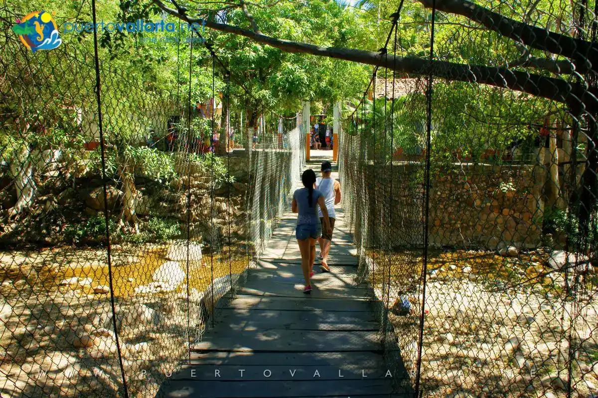
Pedestrian Hanging Bridge, Cuale Island downtown Puerto Vallarta
Gringo Gulch is the favorite bohemian part of the historic downtown area, the place where artists, actors, directors and other gringos (foreigners from north of the border) established themselves starting off in the late 1950s and ’60s up until today.
This pedestrian footbridge offers a spectacular view of the Romantic Zone to the south, the surrounding mountains, the Cuale river and, you can also catch a glimpse of the Pacific Ocean.

A bit of history
The island was settled for some time until 1971 when precipitations from a passing Hurricane Lily caused the river to grow and the island was completely flooded. Residents were moved to a new “colonia” called “Pa’lo Seco” (Where it’s dry) further up the river and on higher ground.
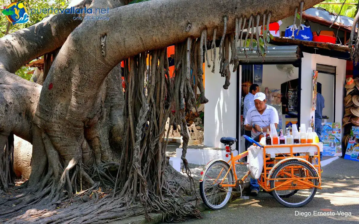
Crushed ice (raspados) ice-cream Isla Cuale
In 1975, workers dredged the riverbed to establish the island as a permanent feature. The island at that time was also called Children Island because it was used as a recreational area, and then became a cultural space full of people, activities, and happenings that have defined Puerto Vallarta’s history.

Isla de los niños (former name of the Cuale River Island)
These include the washerwomen, who, until the end of the ’60s were a permanent fixture on the island, washing clothes under small palapas they made with branches and palm fronds. Children enjoyed the area splashing in the river or taking rides floating along on inner tubes.
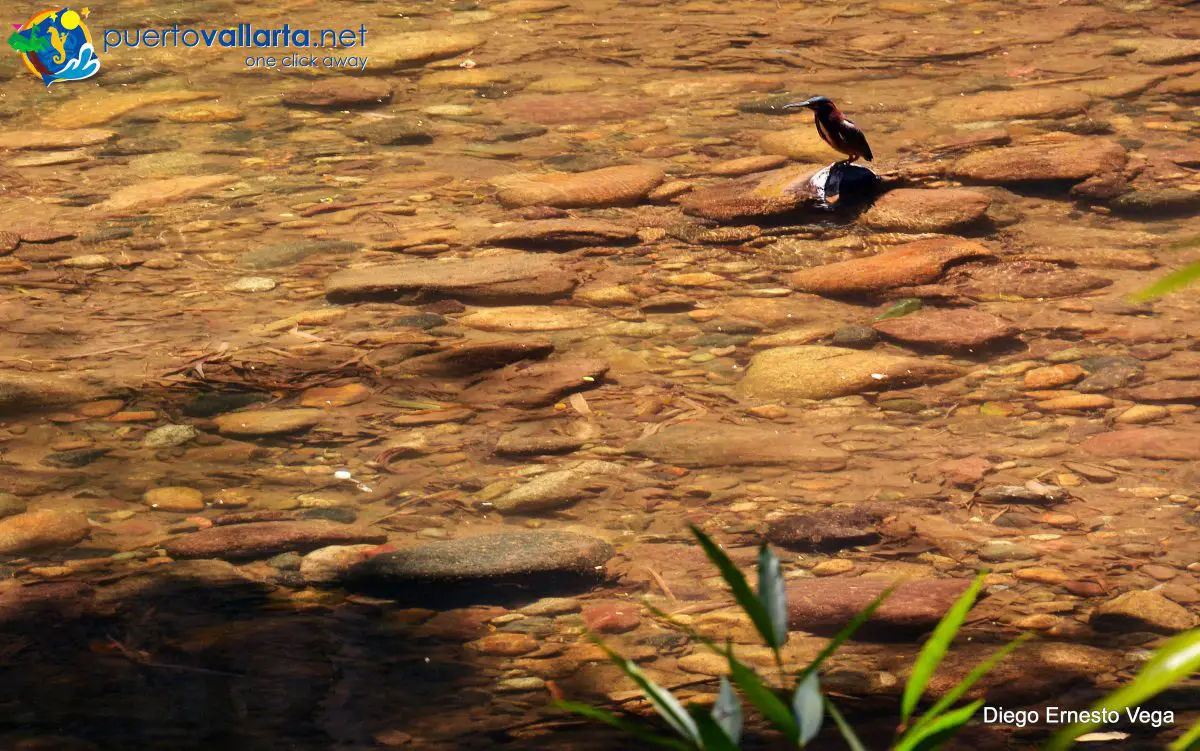
Cuale River flows through downtown Puerto Vallarta
What to do on the Island
The growth of the city and the tourism boom changed the Island into a meeting and marketplace and enriched it with various new options, a museum, restaurants, bars and more.

Le Bistro, Isla del Río Cuale, Puerto Vallarta
The Cuale Island today offers, a museum and the Cuale River Cultural Center, a business side with restaurants, shops, and stands that offer everything from silver, ceramics, sombreros, hammocks, and souvenirs, with little parks, benches, sculptures, and art.

Isla del Río Cuale Flea Market stands
You’ll also find John Huston‘s statue, a tribute from the 25th anniversary of the movie he shot in the area that pushed the city into the limelight and into the world tourist map, The Night of the Iguana.
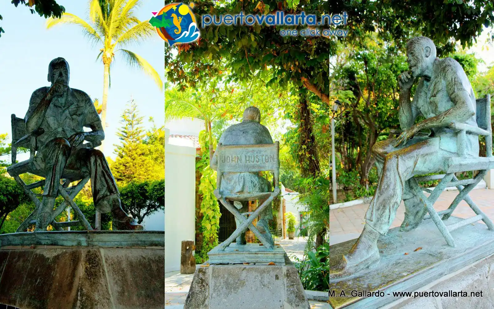
John Huston Statue, Isla Cuale
If you walk to the West, the Pacific side, you’ll arrive at the cute Museo Arqueológico del Cuale (Cuale Archaeological Museum) that offers a small but impressive collection of pre-Columbian figurines.
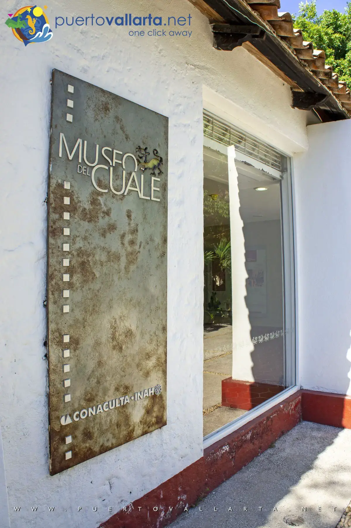
Cuale Museum (Museo Cuale)
Cuale Island “What to do” Map
Don’t miss the chance to visit Cuale River Island when you are in town, you’ll surely enjoy it, the colours, the different options, and the calm ambiance.
How to get to the Cuale River Island?

Cuale River island, Downtown Puerto Vallarta
Looking at the map, you can see that Cuale Island is the green area between the Puerto Vallarta downtown area, which lies to the north, and what’s known as the Romantic Zone (Old Vallarta) that lies south of it. You can walk down to the island from various points, from the seaside to the Gringo Gulch (Cuauhtémoc Street) and Aquiles Serdán street.
- From the west (bayside), you can walk south along the Malecón, then Malecón II and start over the river along the pedestrian bridge, halfway over you’ll see some stairs going down to the left, that’s your way down to the island.
- If you walk south from the main square and Malecon along Morelos street, you’ll go over a bridge, on the right side there are stairs going down to the island.
- You walk along Libertad street, you’ll end up going over the bridge along Insurgentes, halfway over there are stairs going down on both sides of the street.
- Another way to get to the island is on the corner of Encino Street and Matamoros, to the south there is a hanging bridge.
- You can go down to the island from Cuauhtémoc street (Gringo Gulch) along the Iguana bridge.
- You can cross over from the Southside from Aquiles Serdán street between Aguacate and Jacaradas.
- There’s a final hanging bridge that was washed away some time ago and I am not sure it’s back in place, but it goes from the south side from Constitución and 5 de Febrero streets.
Cuale River Island Location Map
FAQ

Book tours & support us
- Best prices
- 100% Local Support
- 2 decades+ of experience in Puerto Vallarta

Puerto Vallarta news, tips & content
- New info every two weeks
- Free content, news, videos
- Unsubscribe at any time

Contact us via WhatsApp
- Talk with our reservations expert
- Real local and human support
- Book tours, hotels, transfers, and more.
Last updated on:
Share this article, choose your favorite option!


