Features & amenities
Restaurants
Bars
Hotels
Land Activities
Water Activities
Shopping
Riviera Nayarit
Lo de Marcos at a glance
- Lo De Marcos is approx. 80 minutes from Puerto Vallarta – Highway 200 can add a lot of time
- Population: 2099 (2020 INEGI census, not current)
- Coordinates: 20.9537° N, 105.3540° W,
- 8m over sea level
- Activities: beaches, fishing, hiking, golf, kayaking, windsurfing, surfing and horseback riding
- Closest towns: Rincón de Guayabitos (15 min N) and San Pancho (15 min S)
- Approximately 32 miles (52 km) from Puerto Vallarta International Airport by road
- In the same time zone as Puerto Vallarta & Guadalajara, Central Standard Time (UTC−6) year-round
- Best for: Quiet beach days, slow travel, and a break from busier Riviera Nayarit towns
Introduction
Most people drive past Lo de Marcos on Highway 200. The turnoff does not look like much. Follow the main road through town and it ends at a long Pacific beach with green hills behind it.
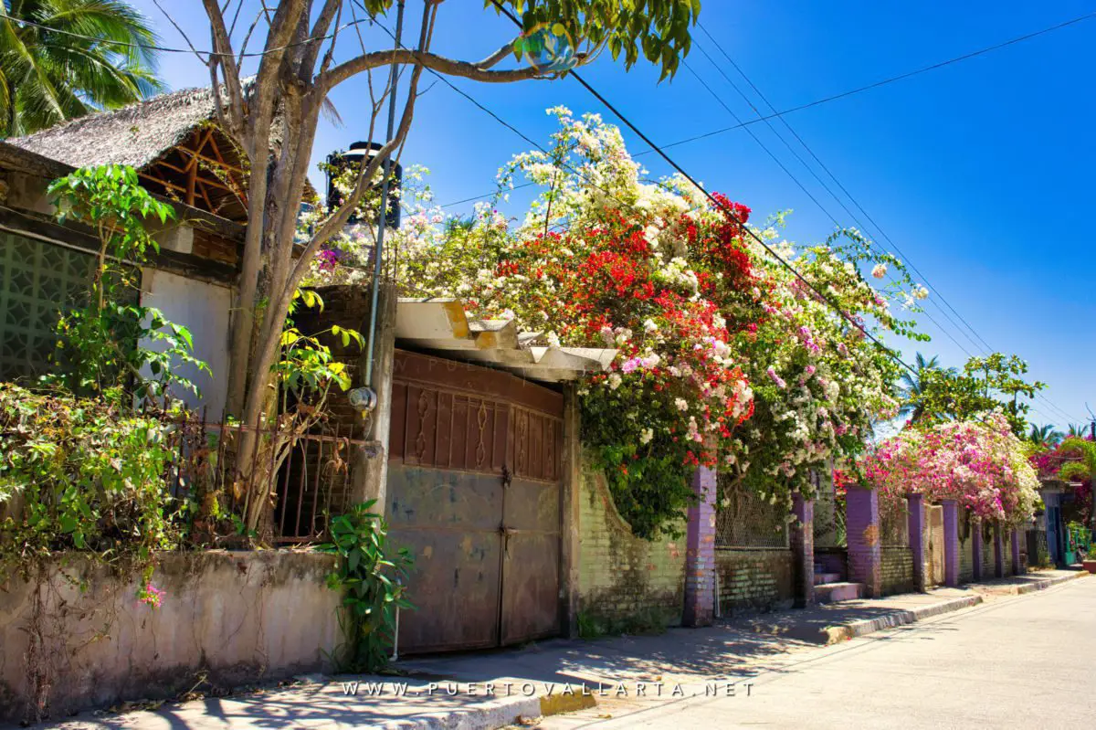
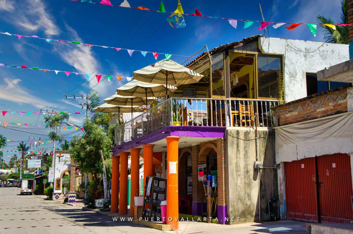
The town is quieter and less polished than Sayulita or San Pancho. Modest homes, flowering gardens, a plaza, small hotels, RV parks, family restaurants, and fishermen working near the shore. No high-rise hotel strip. Not much nightlife. For a lot of people, that is the point.
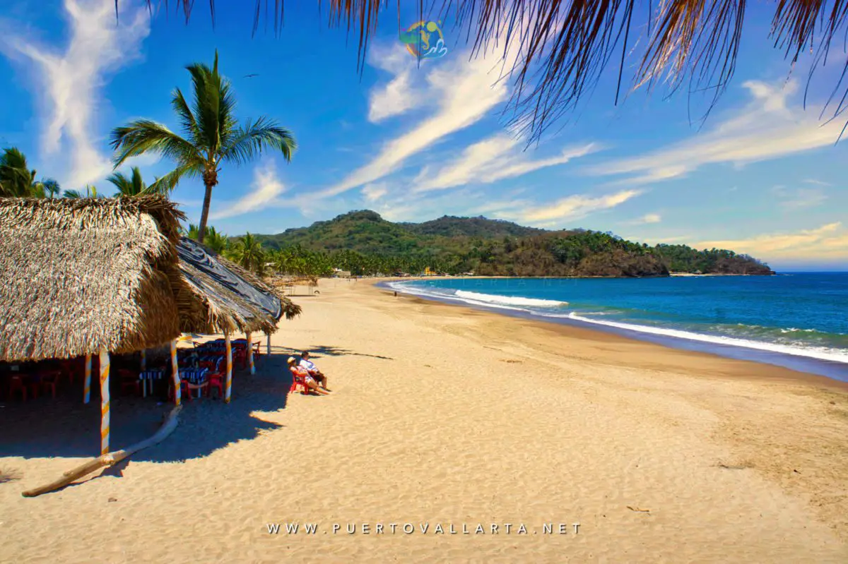
If you want a packed list of attractions and late bars, this place will feel sleepy. If you want a broad beach, seafood, quiet streets, and a look at ordinary life on the Nayarit coast, it is worth the turn.


Is Lo de Marcos right for you?

Fishing nets, modest houses, flowering trees, and the plaza are just the town. Services are thinner than in Puerto Vallarta, Sayulita, or even San Pancho.
It works as a day trip from Puerto Vallarta, though the drive back makes an overnight stay easier. Between Lo de Marcos, San Pancho, and Sayulita, the real question is how much activity you want around you. Lo de Marcos is usually the quietest of the three.
The plaza is part of everyday life here. The main beach is wide, open, and backed by hills.
What is Lo de Marcos Beach like?
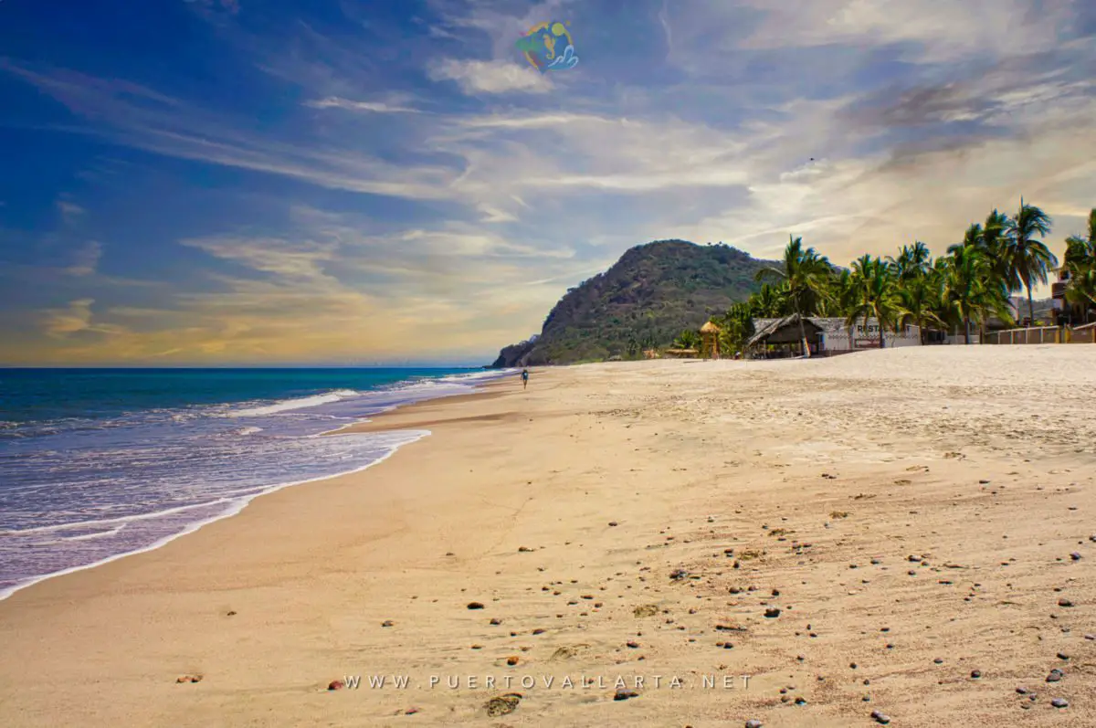
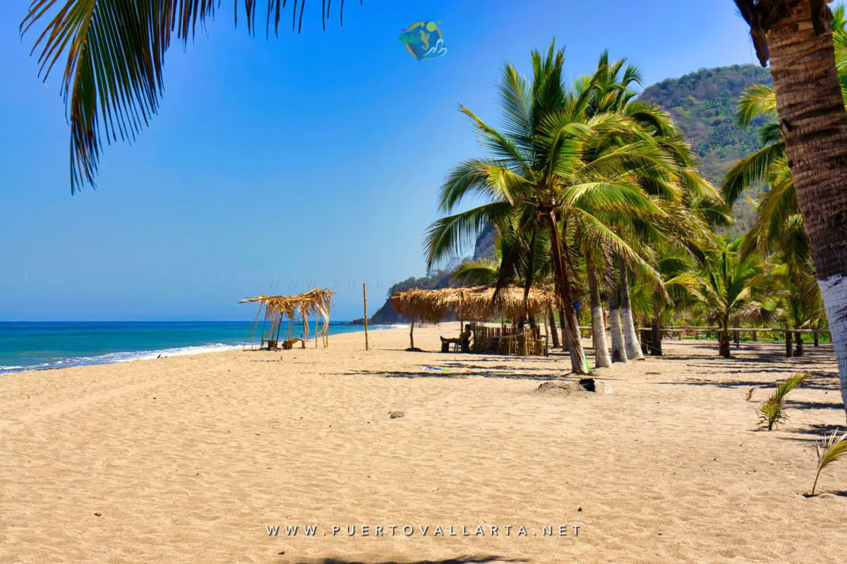
The main beach starts where the town road meets the Pacific. Golden sand, hills behind it, an estuary toward the north, and a rockier stretch toward the south. The center is the easiest section to reach from town, so that is where you will see the most people.
There is room for a long walk, a morning with a book, or a sunset with nothing planned. The beach feels open, not built-up.
Pacific conditions change. Follow flags and local advice, watch children closely, and stay out when the surf or shore break looks rough.
Can you swim at Lo de Marcos Beach?
Some days yes, some days no. Accounts of this beach swing from gentle water to a hard shore break because the Pacific is not the same every morning. Swell, currents, and which stretch you pick all matter.
Look at the water first. Follow posted flags. If it looks rough, stay on the sand.
Nayarit’s sustainability agency keeps environmental-education and water-quality records for the Lo de Marcos Blue Flag program. Blue Flag covers a defined beach section and a program cycle, not the whole coastline all year. Check the signs for the current certified area, services, and daily conditions.
What about the smaller beaches nearby?
Official Riviera Nayarit material lists Los Venados, Las Minitas, and El Atracadero among the beaches around town. El Atracadero is at the south end of the main beach, where rocks and hills change the shoreline.
Los Venados and Las Minitas are quieter coves south of town. Access shifts with road conditions and development. In 2026, Nayarit officials also announced a large tourism project tied to the Minitas and Venados area, so do not treat older directions as permanent. Ask locally about the current legal access point and whether the road suits your vehicle.
Things to do in Lo de Marcos
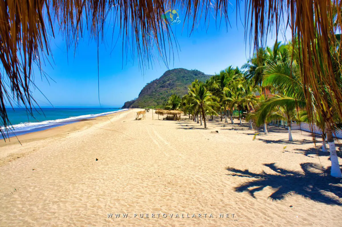
This is a town for unhurried days, not a checklist.
- Accept the slower pace. Winter residents, campers, and RV travelers have mixed with local families here for years. That changes restaurants and the market in season without turning the town into a resort. Walking to the beach and sitting under the palms is still the main activity.
- Walk through town and stop at the plaza. The main road runs from Highway 200 through town, past the plaza, and on to the beach. Small stores, houses, restaurants, and ordinary local traffic. Side streets are easy to wander in the cooler hours. The plaza was renovated in 2009 with help from the civic group Amigos Lo de Marcos, and it is still a natural place to sit in the late afternoon.
- Spend a slow day on the main beach. Bring shade and water. Swim or paddle only if the ocean looks right. If it does not, walk the sand and eat lunch instead. Surfing, kayaking, and paddleboarding happen on this coast, but do not assume rentals, lessons, or usable conditions will be waiting. Check first.
- Ask about fishing with a local guide. Fishing is still part of the town. Use a known local operator and confirm the boat, safety gear, price, meeting point, and cancellation terms before you go.
- Horseback riding and other outings. Riding, guided fishing, and water activities show up on older visitor lists. Operators and prices change. Ask in town and look at the equipment. Golf is in the wider coastal area, not a walk-in activity on the plaza. Confirm the course and reservations if that is the reason for the trip.
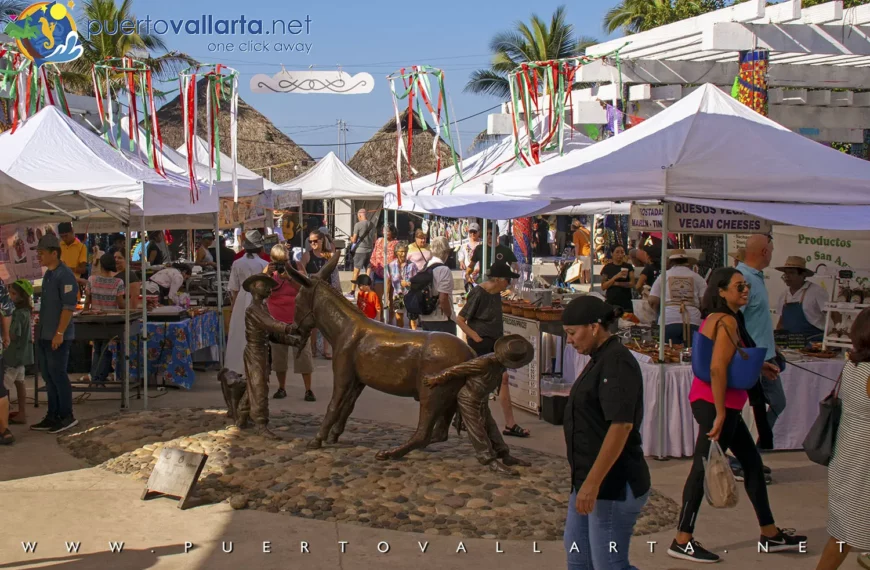
- Look for the seasonal community market. Lo de Marcos has held a seasonal market with produce, prepared food, baked goods, crafts, and music. Hours change, and older write-ups contradict each other. Check the current announcement.
- Sea turtles, if the timing is right. Visit Nayarit lists a turtle camp at Lo de Marcos. Across Nayarit, nesting is generally May through September, with hatching and releases often from July into November. Those are regional seasons, not event dates. For a release, contact the camp or the local tourism office. Go only with an authorized program, keep your distance, skip flash photography, and follow staff.
- Explore the coast, but ask about access first. A car helps for nearby beaches and towns. Smaller roads can get rough in the rainy season, and some mapped tracks cross private land. Ask before heading to Los Venados or Las Minitas.
How to get to Lo De Marcos beach & town?
The town of Lo De Marcos is located on the Pacific side of Mexico, in the state of Nayarit (Riviera Nayarit).
Route from Puerto Vallarta to Lo De Marcos
Driving from Puerto Vallarta or PVR
Take Highway 200 north past Nuevo Nayarit, Bucerías, and the turnoffs for Sayulita and San Pancho. Take the signed turn for Lo de Marcos and stay on the main road toward the plaza and beach.
Plan on about 1 hour 10 minutes in ordinary traffic. Congestion around Puerto Vallarta and Bucerías, roadwork, weekends, and holidays can stretch that. Do not build a tight airport connection around the short estimate.
A car is the most flexible option for an overnight stay or a loop of several towns. Do not leave valuables visible.
Bus
Northbound buses run the Highway 200 corridor. Boarding points, operators, fares, and drop-off spots change. Ask whether the bus enters Lo de Marcos or leaves you on the highway. That difference matters with luggage or in the heat.
Confirm the return before you leave Puerto Vallarta. Carry small peso notes, allow extra time, and ask the driver where to get off. If the stop is on the highway, ask how to get into town. Wikivoyage and local reports often point to a highway stop near the Pemex / convenience-store area, with taxis sometimes waiting there.
Taxi, airport transfer, and ride-hailing
A prearranged transfer is the simplest option with bags or a late arrival. Compare official airport transport with a transfer booked ahead.
Getting a taxi or app car back from a small town is less predictable than leaving Puerto Vallarta. Confirm pickup, fare, and meeting point before you rely on one. Uber may get you north from the city; do not count on it for the return.
Location map
Lo De Marcos’ History

An oral-history account published by BanderasNews, drawing on work attributed to historian Jesús de Ávila, dates the settlement to 1918. In that version, longtime resident Victorino Salazar Mariscal said brothers Oliverio and Pedro Palomera arrived with their sons in a place already called Lo de Marcos. Other local accounts name Don Apolonio Palomera and sons Liborio, Pedro, and Ramón. The land then belonged to the large Camarena holdings based in Guadalajara. Early residents went north to La Peñita for staples and lived off farming, fishing, and the estuary.
Coconuts and tropical fruit were working crops, not scenery. Seasonal crews harvested and processed them, with foremen known as orilleros running the work.
By 1936, in the same historical account, Lo de Marcos had become an ejido under Mexico’s agrarian reforms. Fishing and shellfish still fed families. A recollection attributed to Ángela Cruz Rodríguez put it simply: “Back then, we fished to eat, not to sell.”
Her memory of the “Tropical” transport in the 1950s is the detail that sticks. Wooden benches, a canvas cover, no real doors or windows. Uncomfortable by later standards. For a child in a community of fewer than 500 people and almost no cars, it was the link to neighboring towns.
Roads and tourism slowly changed the economy. Bungalows, small restaurants, and RV parks appeared. The town grew and stayed lower-rise than the places that developed faster to the south. Civic work, including the 2009 plaza renovation, cleaned up the center without turning it into a stage set.

Where To Eat?
Look for what the town already does: seafood, tacos, antojitos, simple breakfasts, baked goods, and casual meals. Hours and menus shift with the season.
Near the beach, ask what fish is fresh and how it is cooked. Around the center, look for taco stands and family kitchens with ceviche, pozole, and everyday Mexican food. Coffee, pastries, and a few North American dishes show up more in winter.
Skip years-old restaurant lists. Check a current map, look for recent activity, and confirm hours. Carry cash. Card terminals and internet connections are not guaranteed. If you have dietary limits, say so clearly in Spanish and ask how the dish is made.
Where to stay
Lodging here is small-scale: bungalows, villas, hotel rooms, rooms attached to local houses, and RV parks. That fits the town better than a resort list.
Staying in town means you can walk to the beach and live with a short restaurant list and quiet nights. Check the exact pin. “Lo de Marcos area” can mean a property outside the walkable center. “Near the beach” does not always mean a direct path to the sand.
Ask about air conditioning, hot water, Wi-Fi, parking, stairs, and cancellation terms. In the wet months, ask about road access after heavy rain. Do not trust an old quoted rate.
Luxury resorts in the broader Mandarina area are nearby on a map. They are a different stay. If you want full-service luxury, nightlife, or a wide restaurant scene, base yourself somewhere else.
Practical advice
- Bring pesos. Useful for small restaurants, markets, buses, and local services. ATM availability changes, so withdraw what you need before you arrive and do not carry more than you want to hold. Use a well-lit machine during the day.
- Plan for heat, rain, and mosquitoes. The regional rainy season generally runs from late June into early November. Summer is hotter and more humid, and downpours can chew up smaller roads. The drier winter months are easier for walking and bring more seasonal visitors. Use sun protection, drink water, and walk in the morning or late afternoon. Bring insect repellent, especially near the estuary.
- Treat the ocean as its own risk. Lo de Marcos is a small town, not a risk-free town. Secure valuables, do not flash cash, ask before walking unfamiliar routes after dark, and use established transport. A calm street says nothing about currents or shore break. Read the beach each day.
Nearby Destinations
San Pancho
About 6.8 miles (11 km) south. More dining, cultural activity, and visitor services, still on a small-town scale. A better pick if you want a quieter coast town with more to do after dark.
Sayulita
Farther south and much busier. More shops, restaurants, bars, and surf traffic. Choose it if variety matters more than quiet.
Rincón de Guayabitos
North of Lo de Marcos, with a more developed family-vacation feel and a wider range of services. Practical if you want an established beach destination rather than a small village.
Chacala
Farther north. Better as its own day trip or overnight stop. Do not tack it onto a packed Puerto Vallarta day. The highway takes time.
Conclusion

Lo de Marcos will not suit everyone, and that is part of what keeps it different. Come for the broad beach, the quiet streets and the slower pace. If you need nightlife and a long restaurant list, continue to Sayulita or San Pancho. If you are happy with a beach, a plaza and an afternoon without much of a plan, take the turnoff.
References
- BanderasNews: An Idyllic Mexican Pacific Coast Village
- INEGI: 2020 Population and Housing Census quick results
- Riviera Nayarit: Lo de Marcos
- Visit Nayarit: Bahía de Banderas
- Nayarit Secretariat of Sustainable Development: Lo de Marcos Blue Flag environmental education
- Visit Nayarit: Sea turtle season in Nayarit
- Diario Oficial de la Federación (Mexico’s time zone law 2022)
- Riviera Nayarit: Regional weather
- Grupo Aeroportuario del Pacífico: Puerto Vallarta airport ground transportation
FAQ
The main beach, a walk through town and the plaza, a meal at a local restaurant, and the southern coast if access and roads allow. A seasonal market, fishing trips, turtle-conservation visits, horseback riding, and nearby golf may be available. Confirm current operators and dates.
About 32.5 miles (52 km) from Puerto Vallarta International Airport. The drive is often around 1 hour 10 minutes in normal conditions. Traffic and roadwork on Highway 200 can make it longer.
Yes. Buses use Highway 200, and a transfer or taxi is another option. Confirm the boarding point, fare, schedule, and whether the bus enters town or stops on the highway. A car is easier if you want outlying beaches or several neighboring towns.
Sometimes. Pacific conditions vary. Check the water, flags, and local advice when you arrive. Strong currents and shore break can make swimming a bad idea, especially for children and weak swimmers.
No. It is a coastal town in Nayarit. It does not hold Mexico’s official Pueblo Mágico designation.
The drier winter months are more comfortable and bring more seasonal services, along with more visitors. Summer is hotter and more humid. The rainy season generally runs from late June into early November. If a market or turtle release is the reason for the trip, verify those dates before you book.

Book tours & support us
- Best prices
- 100% Local Support
- 2 decades+ of experience in Puerto Vallarta
Puerto Vallarta news, tips & content
- New info every two weeks
- Free content, news, videos
- Unsubscribe at any time

Contact us via WhatsApp
- Talk with our reservations expert
- Real local and human support
- Book tours, hotels, transfers, and more.
Last updated on:
Share this article, choose your favorite option!